
Hiking Trails
in Pacifica
Enjoy over 100 miles of hiking, biking, and equestrian trails in Pacifica with panoramic beach views. Hike Montara Mountain from San Pedro Valley Park for 360-degree views, including the Golden Gate Bridge on clear days. Mori Point and Milagra Ridge offer stunning coastal views and are great for whale watching and sunsets. Explore Sweeney Ridge, Pedro Point, and Devil's Slide for more fantastic trails. Grab your gear and start exploring!


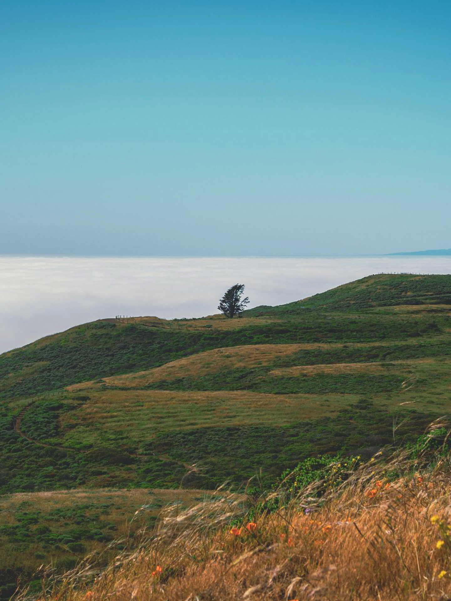
Milagra Ridge
Milagra Ridge’s scrub-covered ridgeline runs east to west, offering impressive views of the cliffside city of Pacifica, the ocean and the coast. This protected ridge is the focus of community efforts to restore the wildlife habitat and help ensure the survival of a number of rare and endangered species found within this national parkland. The ridge is critical habitat for the endangered Mission Blue Butterfly and home to Redtailed Hawks, often seen spiraling overhead.
The 330-acre Milagra Ridge Military Reservation was acquired in 1942 during World War II for use as a coastal defense installation. Two coastal batteries were planned, Battery 244 was started in 1942 but not completed until after the war in 1947, Battery 130 was never built. Battery 244 was decommissioned in 1950. The reservation was used by the U.S. Army Defense Command for anti-aircraft missile Nike Site, SF-51, during the Cold War. The reservation was finally closed in 1972 and portions transferred to the City of Pacifica in 1974.
The hiking is mostly level and mostly paved. Visitors are required to stay on trails and pets must be leashed. Bicycles are permitted on the paved trail only.
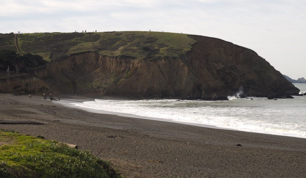
Mori Point
For nearly a century, Mori Point served as a haven for settlers, travelers, bootleggers and diners. Today, this spectacular locale serves as a haven for walkers and wildlife. A recent addition to the Golden Gate National Recreation Area (GGNRA), Mori Point is considered the natural coastal extension of the National Park’s Sweeney Ridge area, located due east across Highway One.
At Mori Point, visitors can stroll along paths through wildflower fields, visit restored habitat for threatened species and marvel at the dramatic coastline from the upper trail that extends all the way to the western edge of Mori Point.
From the coastal blufftop, visitors will marvel at the dramatic coastline, stretching north beyond Pacifica to the Marin Headlands and, on a clear day, Point Reyes. To the south, one is surprised and entranced by the sudden view of the beautiful but inaccessible hidden cove, and beyond, the Rockaway and Pedro Point Headlands. Also visible is the Pacifica Pier, Sharp Park Beach and the earthen berm supporting the Coastal Trail and separating the beach from the Laguna Salada freshwater marsh and the Sharp Park Golf Course.
Benches are available for sitting and enjoying the vista. The top of the point is a great whale watching location and sunsets from Mori Point are spectacular.
San Pedro Valley Park
A vast area embracing the middle and south forks of San Pedro Creek, which is Steelhead spawning grounds, this park is nestled amongst the Santa Cruz Mountain range and the foothills of Pacifica. The park offers group picnic areas, family picnic sites with barbecue pits, a self-guided nature trail, hiking trails, a visitor center and views of the picturesque, seasonal Brooks Waterfall.
San Pedro Valley Park is a walker’s paradise. There are trails for all ages and fitness levels, ranging from the Valley View Trail to the wide vistas of San Pedro Valley and the Pacific Ocean from the top of Montara
Mountain. The facilities at San Pedro Valley are primarily for day use only. Two picnic areas are available by reservation, the North Walnut Grove (accommodates 100) and the South Walnut Grove (accommodates 200).
A visitor center near the park entrance displays exhibits about the ecosystem of San Pedro Valley and its plant and animal species, with some live exhibits. No dogs are allowed in the park. Bicycles are allowed only on Weiler
Ranch Road.
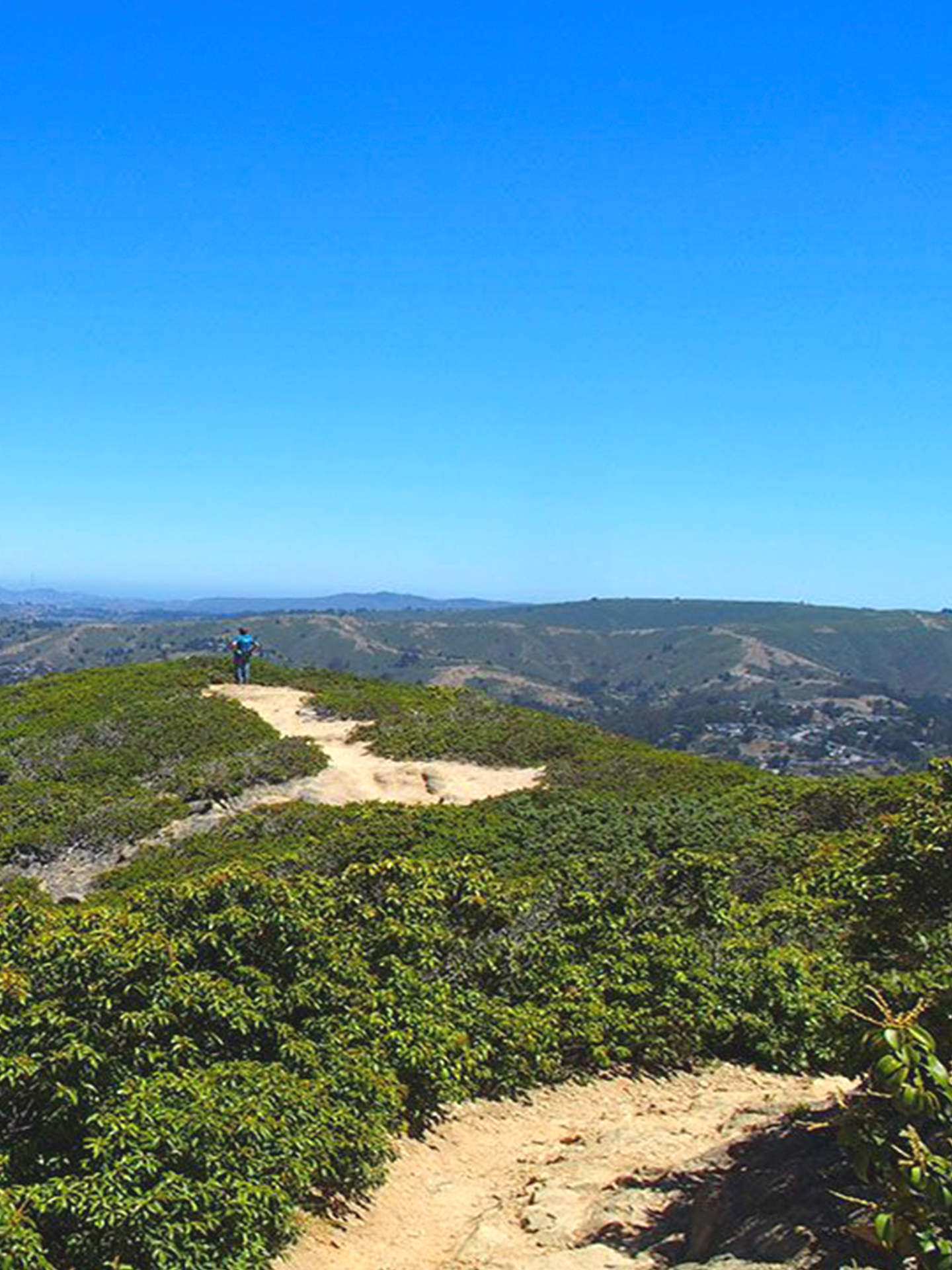
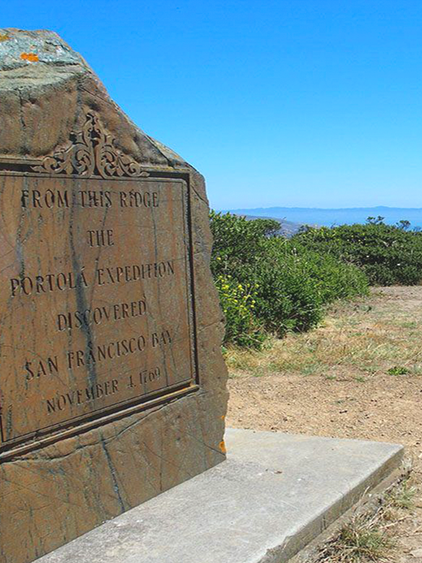
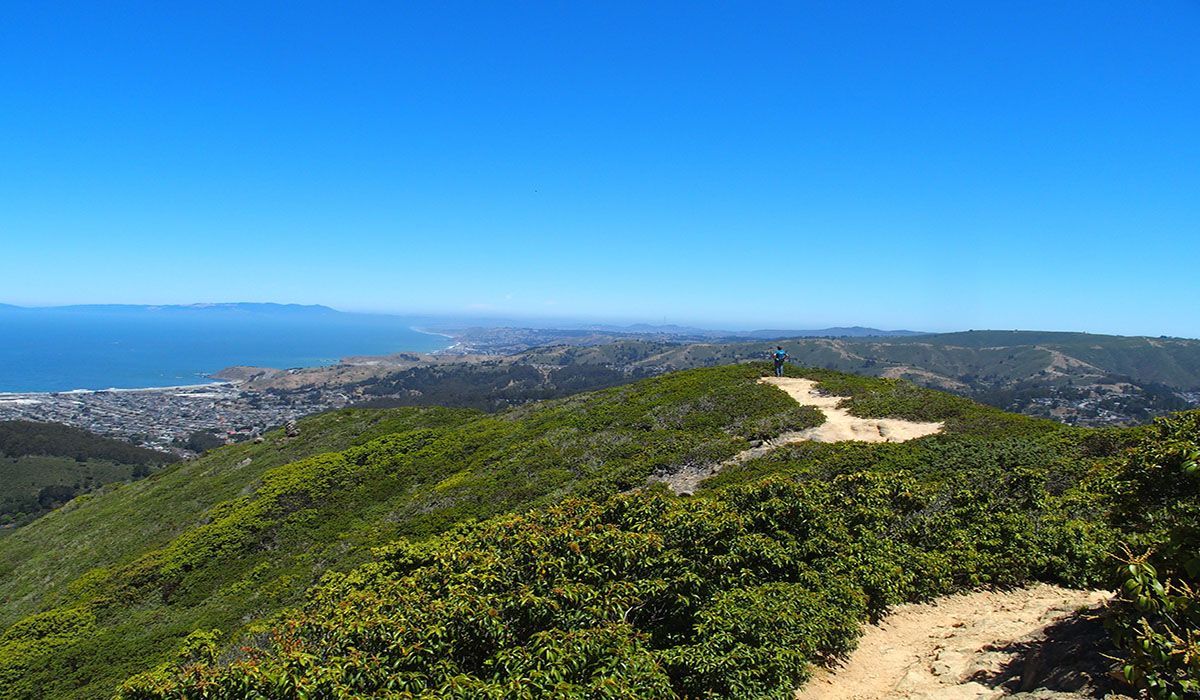
Sweeney Ridge
In 1769, a scouting party led by Gaspar de Portola became the first Europeans to see San Francisco Bay, from the ridge top of Sweeney Ridge, where a monument marks the momentous occasion.
Sweeney Ridge is a federally protected hiking area of ridges and ravines between San Bruno and Pacifica where steep and rolling coastal hills overlook the San Francisco Peninsula, San Andreas Lake and the Pacific Ocean. The ridge’s 1,200-foot-high summit, covered with coastal scrub and grassland, slopes down to the bay on one side and to the Pacific on the other. Wildlife includes hawks, deer and a plethora of spring wildflowers.
On a clear day, you can see the City of Pacifica and the shimmering Pacific Ocean and coastline. In the springtime, the hills turn gold with California poppies and other wildflowers.
On Sweeney’s crest, beyond the abandoned former missile site, look for the stone plaque honoring Portola’s expedition. A nearby granite monument directs you to views of this scenic San Francisco Bay Discovery Site, including the Farallon Islands, Mt. Tamalpais, Point Reyes, Mt. Diablo, Montara Mountain and San Pedro Point. The trail is open to hikers, equestrians and bicyclists.
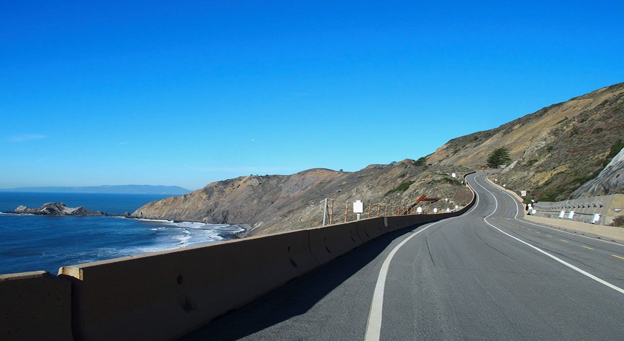
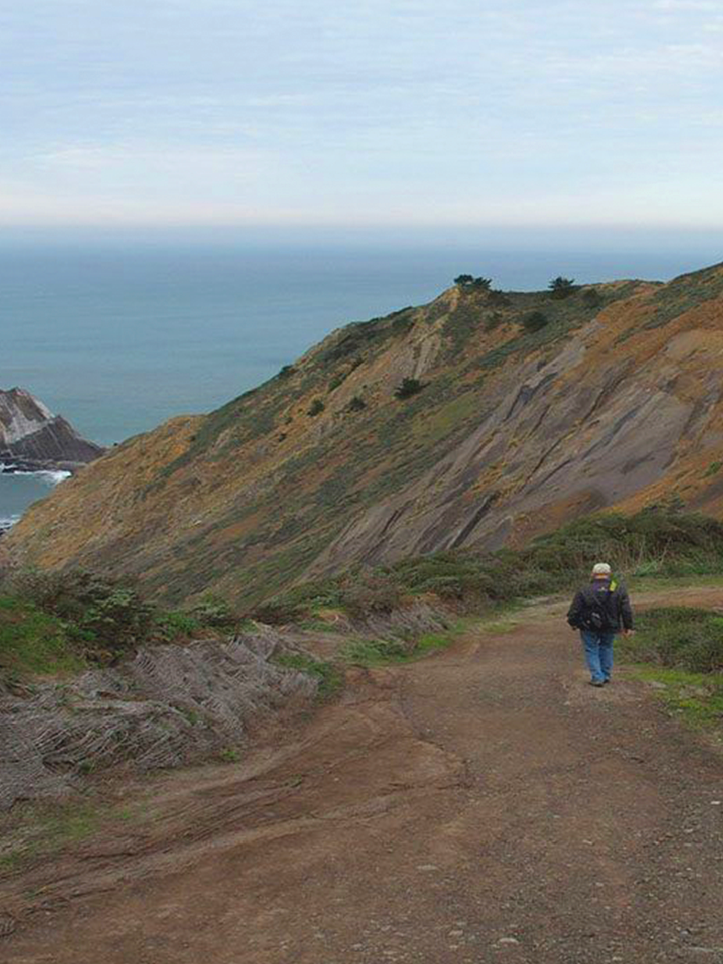
Pedro Point Headlands
Pedro Point Headlands features 246 acres of dog-friendly wildlands between Pacifica and Devil's Slide. It is bounded on the east and south by the Coast Highway, which climbs to over 400 feet at the Devil's Slide parking lot. From the east side, the hills slope up from Eucalyptus forest to coastal prairie near the top of the bluffs. The west side consists of steep bluffs that drop 5-600 feet to the ocean. The park offers extraordinary views and a wide variety of birds and wildflowers.
The moderate 2.3 mile loop covers most of the features and trails in the park, with the exception of the spectacular San Pedro Rock, which can only be reached at very low tide via a hike from Linda Mar Beach to San Pedro. The highlight of the park is the Bluff Trail with gorgeous views of headland cliffs, San Pedro Rock, Devil's Slide and the Pacific coastline, which on clear days extends as far as Tamalpais and Point Reyes. Once you reach Pedro summit where a sign is posted, you can look down at Linda Mar Beach and watch surfers while they wait for the next set of waves.
The route goes up the South Ridge Trail, continues to the far end of the Bluff Trail and returns via the Middle Ridge and Arroyo Trail, which is mostly a steady climb, but it is not as steep as the others. Between the junction and Pedro Summit, the Bluff Trail has some very steep sections, but they are fairly short.
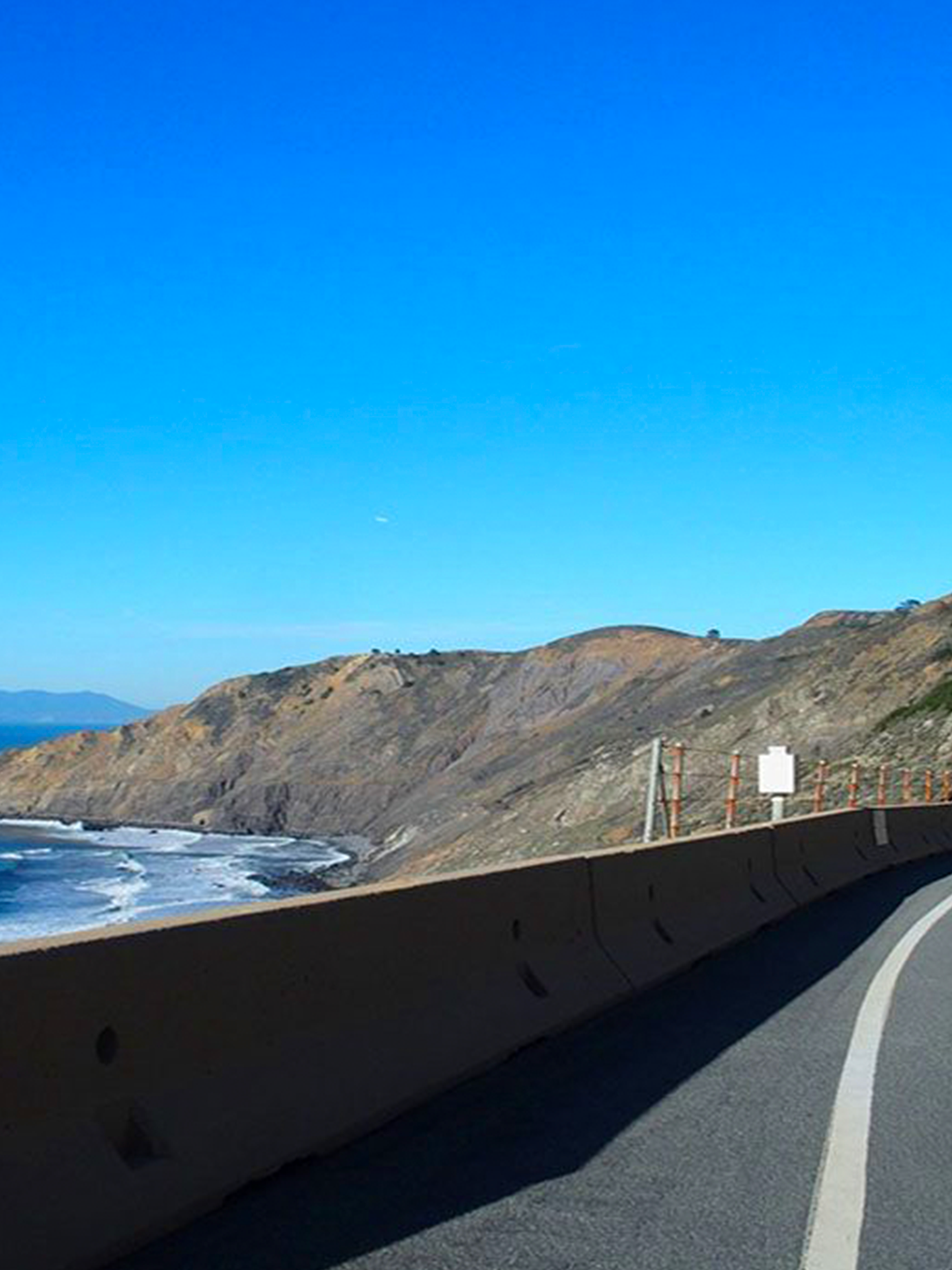
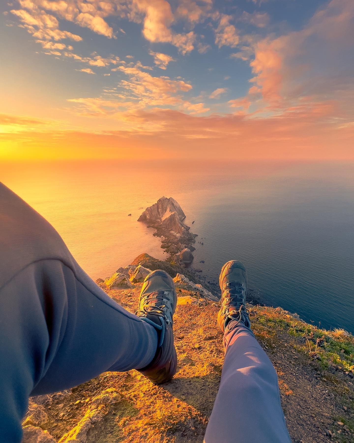
Devil's Slide Trail
The Devil’s Slide Trail is a 1.3-mile, multi-use trail, converted from a former segment of Highway 1, that gives hikers, runners, bicyclists and equestrians access to the rocky heights of Devil’s Slide above the Pacific Ocean.
There are benches for resting and observation scopes for taking in the view of the rocky coastal waters below at designated lookouts. At key points along the trail, there are interpretive signs that describe the history, geography and marine and avian communities that live and migrate here.
The trail is paved with separate lanes for hikers and directional bike traffic. Many convenient amenities are provided as well, such as pet waste stations, bike racks, drinking fountains and restrooms. Devil’s Slide Trail is a segment of the California Coastal Trail that, when finished, will extend 1,200 miles from Oregon to Mexico, connecting travelers to California's varied oceanside landscapes.